What if analyzing ecological corridors became accessible, despite the challenges of creating your maps and the heavy workload on your teams, even as your projects pile up?

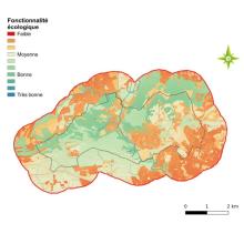
Between the modeling tools to manage, the data to gather, and the technical and scientific expertise required, assessing the ecological functionality of a region can quickly become a daunting task. This is especially true when results must be delivered within tight deadlines and budgets. 

Especially since ecological connectivity is becoming a must: the Green and Blue Network (TVB), the Municipal Biodiversity Atlas (ABC), the Joint Development Zone (ZAC), the BiodiverCity label, renewable energy projects (EnR), etc. 
 mc-chamayou  

Facilitating the analysis of ecological corridors without compromising scientific integrity

Making the analysis of ecological connectivity more accessible is becoming a key challenge for environmental assessment to scale up and integrate seamlessly into a landscape-based approach to species conservation. Due to urbanization, the accumulation of infrastructure, and degradation, natural habitats are shrinking and becoming fragmented. 

 mc-chamayou  

How can we ensure that restored or recreated habitats will truly be functional for the target species?

Natural Sites for Compensation, Restoration and Renaturation (SNCRR) now mark a key milestone in structuring ecological compensation projects. This mechanism, created under the French Environmental Code on October 23, 2023, is unique in Europe and carries a strong ambition: to generate real, measurable, and lasting ecological gains for species and habitats.

But a question quickly arises:
How can we ensure that restored or recreated habitats will truly be functional for the target species?

 mc-chamayou  

Are you wondering about the relevance of ecological modelling techniques?

Are you wondering about the relevance of ecological modelling techniques? You are quite right to do so.

The use of these tools is becoming increasingly widespread, not only in research, but also as a decision-making aid in the field for all those involved in land use planning and biodiversity conservation.

The problem is that in most cases, their reliability is never assessed. 

 mc-chamayou  

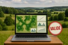
We're certified, and we forgot to celebrate!

Since last April, TerrOïko has obtained Qualiopi certification, which validates the quality of our training programs (and allows the people we train to apply for public funding).

What do we offer? Learn how to use SimOïko, our animal life simulation software.

This is what the teams at the Charente Departmental Hunting Federation (FDC16) are currently doing.

 mc-chamayou  

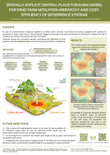
TerrOïko presents the SimOïko module “Central Place Foraging”

This week, we are attending the 8th Conference on Wind energy and Wildlife impacts - CWW2025, the leading international event on wind energy and its interaction with biodiversity, which is being held in Montpellier (France) until Friday.

As part of the poster sessions, we are presenting a special feature of our ecological simulation software SimOïko, specifically designed to analyze the risk of collision between flying species and wind turbines.

 mc-chamayou  

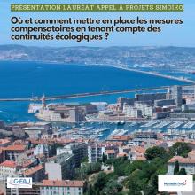
Focus on one of the projects selected during our call for projects!

Remember! At the end of December, we announced the winners of our call for projects involving the use of our SimOïko software.

Today, we take a closer look at one of the selected projects: that of Jeremie Solere, a CIFRE scholarship doctoral student. The project is jointly led by the Port of Marseille Fos and the UMR G-eau laboratory in Montpellier.

 mc-chamayou